Saturday, September 28, 2013

My First Packrafting Adventure: Manistee River, MI - Sept. 28-29, 2013

Manistee River Trail near Baldwin,MI + Packrafting

Overview: Day 1 - Arrive and Hike the 11 miles of the MRT, Day 2 - Packraft the Manistee River back to the car.

We drove up early in the morning in order to make complete the full Manistee River Trail on Saturday. We planned to camp on the location we had 1 year ago when we did the MRT + North Country Trail Loop.

This was also the first camping/backpacking trip with my new car AND my new packraft. The goal of the trip was to get out camping one more time before the colder fall weather came, but also to try out my new packraft. With a smaller pack already, it was tough to fit in the gear and the packraft, but somehow I managed. Personally, I was really worried about my gear leaking and things getting wet. The shortness of the 1 night trip was all the we could fit in. In general, this was my first chance to also figure out how well all my water/rafting is going to work out. Chances are, I would identify that something should change in order to improve things for the next trip.

The trail views of the Manistee River were just a great as I remembered.
View from one of the mid-campsites along the MRT.
We scoped out of the river for debris. We'd be rafting back through here the next day.
We ran into this little guy on the trail.
In addition to the new packraft, this trip was also a chance to try out the MLD Trailstar.
The campsite and campfire before the packrafting trip.
The Trailstar before the rest of the gear is underneath. We had plenty of space here, and even got to test it out against the rain. Except for a ripping bivy sack (mine..booo....), it worked out really well. We still have to work on learning to pitch it lower, but it still protected from the rain very well.
A pic from inside my packraft. I don't have many since I wanted to keep my phone secure.
Mike on his packraft.


In summary, the weather for the packrafting could not have been more perfect. I was just under 70F and the water, was cool, but not freezing. I did have some trouble with my spray skirt leaking into my boat and getting my pants and sleeping pad all wet. Going forward, I'll have to figure out whether I can fix this or will have to move my sleep pad so that it protected from the leaks will seem inevitable.

Stay tuned for future trips in 2014!


Saturday, July 6, 2013

Smokey Mountain National Park: July 2-5, 2013

Overview:

I will begin with a few disclaimers about this post. This whole trip was planner spur of the moment when our original trip planned to Rocky Mountain National Park was cancelled. We cancelled with ourselves after a painful-cancelled flight experience at the airport and then lost camping luggage. After we finally decided to drive down to SMNP for the remaining of the vacation days we already planned off.

Unfortunately, we weren't lucky with the weather at SMNP (rain, thunderstorms, and more rain) so I don't have any picture worth sharing. The second issue we rain into with with the torrential rain we experienced was the we weren't prepared. Not prepared for the gear that was going to get wet and not prepared for the train conditions (all washed out.) Overall we were not able to move at the rate we had planned, and I personally needed to have a much better system for keeping my sleeping gear dry. It was just too cold to sleep in all wet stuff.

http://www.nps.gov/grsm/planyourvisit/maps.htm

Day 1: Elkmont Campground to Campsite #23

We took this 7 miles of trail to this campsite. The site was right along a creek and down in a more low ground. This backcountry site has nice space and even spots for campfires. Unfortunately, with the previous rain, there was no wood for fires. We did manage to use have enough dry twigs with the Backcountry Boiler, but that was it. Immediately after dinner, it rained for most of the day and night.

Day 2: Summit Hike AT to Campsite #84 #26

This next day was supposed to be a hike on and over the AT - a long day - something planned around 13 miles with some serious vertical climb too. The morning had no rain so we were glad to pack up camp and be on the way. By the time we reached the summit line (along the AT), there was fog everywhere and no views and no pictures. Instead will put on more rain gear as the temperature cooled and we just keep get wet. Soon after we left the AT for Hazel Creek Trail, I knew this was too much "wet" for me. I was cold and already concerned about how wet everything was going to be. Worst of all, we near that the weather was going to get more intense over the next 2 days. All rain without an opportunity to make a fire (we need to perfect the skill of making a fire in the rain) and no sun to dry out gear. We eventually decided that it was a better decision to back-track campsite #26 and plan to head out of the pack 2 days earlier. We weren't ready for this much of a wet trip. I had already learned I need a dry by for things like my wool clothes and my sleepbag.

At campsite #26 we discovered the drawback of the BackCountry Boiler and not having dry wood. We also learned what happened when you get all your lighters wet. (None worked.) After being cold and "enjoy" a cool dinner because we couldn't heat any water. I learned that we have have some skills to so acquire it we want to manage though conditions like these.

We managed through the night (it never stopped raining for the entire evening and night) since it wasn't too cold - just wet.

Day 3: Campsite #26 to Elkmont

In the morning we were ready to leave. We did have a conversation about staying out one more night, but that consideration was quickly closed when we realized there wasn't much to see since we would be encountering more thunderstorms. One key learning was that fact that the trails were so washed out with mud (in some place were like little streams), we moved at a slower rate than normal to keep good footing. We need to consider this time when planning trips in the future that may encounter these types of conditions.

The rest of the hike back to Elkmont was all in all a nice hike - mostly down. Of course, we had hope to see some wildlife - but didn't encounter much. Everything we had read reminder us that there was at least 1 bear for every sq. mile in the park. As one could imagine we didn't see anyone else on the trail that day until we got much closed to the Elkmont Campground. There we saw a few people running day hikes out from there. I was secretly jealous of how their campsites were probably better protected from the wet rain.

Although we had to shorten the trip, I was the right and safer choice. We learned alot about our comfort zone and capabilities. This stretched me and taught me, that I need to manage the rain better - and plan for that better. We definitely are looking forward to going back and re-doing this trip. We did learn alot about the park and where we would like to go next, so that was also a plus.

I only wish that I had more positive and insightful knowledge to share on this trip (like my other posts.) The other final comment I would share is that although there is higher altitude in the park, the ruggedness and incline/steepness of the trails themselves are not to the challenging level we encountered out east in the White Mountains. That still ranks as the hardest hiking I'd had yet.

Once we reached the car, we stopped to eat in Gaitlinburg (it was July 4th), and drove the 8 hours back home enjoying fireworks we would see in nearby towns along the drive.

Sunday, October 21, 2012

October 2012 - Fall Overnight Waterloo - Pinkeney Trail

Trip Outline and Highlights:

This trip mainly served as a quick overnight trip to try out the closest trails to Ann Arbor, MI as well as just to test out some of our gear in colder fall temps. The closeness of the Waterloo State Recreation Area was a comfort in case the weather took a turn for the worse.

The access to this trail is very easy off I-94. On Friday Night, we dropped our car off at Green Lake Campground off M-52. The only fee for the car parking was to have the Michigan Recreation Pass for the vehicle. This was where we planned to end on Sunday. My sister was kind enough to drive us over to Portage Lake State Park for Friday night. The trail starts here from the campground.

I am not sure if you can camp at Portage Lake after the State Park is closed, but since it was open we did have to pay full price for the campsite despite having no vehicle. This is an easy place to start, but you should plan on sharing the campground with most RV's and 5th Wheels. We were the only ones in a tent.

Day 1:

After paying the fee for the site in the morning. We hiked off to the start of the trail. Since the trail weaves in and out of some private land, there was a notice that some of the trail is near hunting zones. We checked with the DNR and in October, only certain game and no rifles are allowed. Deer season starts Nov. 15th in Michigan. I don't recommend backpacking past that post. As a precaution, we elected to wear some blaze orange.

The weather was sunny, but chilly around 40F. The trail crosses several back and dirt roads, but in general is very flat and easy.

Around 10 miles around the trail there are some new "walk-in-only" sites that are free and would have been more private than staying at Portage Lake. I would recommend calling the DNR to get more details are whether these sites are still maintained going forward.

The other reason where this site is important to know about is that the "rustic camping" marked on the map is rusting camping, but is really a horse camp. Although we were made an exception, in general you are supposed to be with a horse to camp here. If we were doing this again, would would have better laid out the trip to allow for camping somewhere else instead. The site was huge however, and even had a fire pit so we could warm-up and dry out any sweaty items.
A view of the beautiful (but cool) October Day on the trail.
It was nice when we would see these signs along the trail. Most of it was a shooting free zone since horses are also allowed on the trail.

Sporting the blaze orange hat.
      
Here I am drying out my socks over the fire.


Day 2:

Brrrr, this was the first test of how well the gear does in freezing temps. There was frost on the ground when we woke up. I was thankful to have packed my new down RAB jacket. We had to continue that rest of the 8 miles to the car at Green Lake.
 
There's a Discovery trail and Learning Center over on this section of the trail. There was quite a bit of information on the wildlife in this area. This section of the trail must have been slightly more popular as we saw a few other hikers. (Yesterday we only encountered people on horseback.) We finished up the trail in the early afternoon. The final miles were really quick due to the good trail conditions and the flat terrain. All in all it was a nice final trip for the year!

Here's the trail map of the section we covered. Around 22 miles.
End of the trip pic!


Monday, September 3, 2012

Pictured Rocks National Lakeshore: Labor Day Weekend 2012

Lakeshore Trail: Grand Marias to Munising, MI

4 Days 3 Nights - 39 miles

September 1 - September 4, 2012

Here's the highlights from the Lakeshore Trail, repeatedly referred to as the crown jewel of the North Country Trail (NCT). The weather was awesome. Lake Superior was warm enough to swim, and the trail has incredible views. What a great labor day weekend! This trip required special advance reservations through the NPS of the backcountry sites because those fill up, and you are only allowed to camp in these designated spots in the park.


Day 1 : Grand Marias to Benchmark Campsite

We drove up Thursday night to be able to start our trip first thing in the morning on Friday. We prearranged with Trailspotters to meet us at the Munising Fall Interpretive Center at 9 am. We left our car there and got a ride to Grand Marias Visitor's Center where the trial began. The next time we would see the car would be 4 days later when we would be finishing the trail.


This put the actual start to the hiking around 10:15 am. The first 5 miles of the trail is a nice, wooded section, then at Log Slide, the Lakeshore trail drops you to look along Lake Superior for the rest of the time. You aren't on the sand, but instead looking down at the water from above. This makes for easy hiking, but also boarder views of the shore - hence the trail name: Lakeshore Trail.


View of Log Slide dunes from a lookout point.


Along the way to Benchmark Campsite, there is the Au Sable lighthouse. This is a great place to stop - we ate lunch here - because there is a small museum and little shop to learn about the history of this lighthouse. If you are willing to take the time for the $3 tour of the lighthouse, you can climb to the top and absorb the view (we didn't do this but heard the pictures from there are very nice.) This is the only part of the trail on the first day where we really saw larger groups of people. The NPS Hurricane River Campground is within a 1.5 mile walking distance, so this is a popular day hike. However, all the folks we ran into were so friendly. We even met an older gentleman who had done the AT with his brother, and he now working on section-hiking a trail from the east coast the west coast in small chunks. It was pretty impressive.


Au Sable lighthouse as viewed from Log Slide.


Au Sable lighthouse


Just next to the lighthouse: Mike puts his hand in Lake Superior for the first time.


Benchmark campsite was a great location - pretty much in the dunes right near the lake. At first with the lack of shade it was alittle hot, but the view it offered with the lake-access quickly trumped that. Each of the backcountry campgrounds have 6 sites for up to 2 tents (although some of the sites would have a hard time fitting 2 tents.) You could have fires there, but you have to share the common fire pit. In a way, this is almost better because it give you a chance to hear from the other folks staying in the backcountry site. This is where we ran into my brother's friend, who ended up taking us to watch the Michigan game in town the following night. (Although this turns to not be as great as we had imagined.) At this campground, we were really the only ones there that were hike-in campers. The rest of the individuals had their cars park 0.5 miles away.


First night's tent pitch. Just behind those trees is the beach!


On the Lakeshore Trail. Look to the right, you can see the Lake right there!

Day 2 : Benchmark Campsite to Beaver Creek Campsite

The main portion of this day's hike covered Twelve Mile Beach. The name of the beach literally matches with what you would imagine with 12 miles of white sand and most open, natural beach. At some points, you had to ask yourself if you were looking at Lake Superior or the Caribbean.


View of Twelve Mile Beach


Our tentsite at Beaver Creek. This site had a ton of space and was more wooded.


We left early in the morning, so the hike to Beaver Creek was quick. Once we arrived, we had time to relax and go swimming/wash off in the lake. It was a warm, sunny day. So perfect.


Beaver Creek campground's bench!

Here is Beaver Creek ending into Lake Superior. This beach spot went on for miles with practically no one there.


Again we were the only folks in the campsite doing the complete Lakeshore trail, but we did meet some people who had kayaked in. Another group was on a fishing trip in Beaver Lake. They were alittle rowdy, but jealous we were going to watch the Michigan game.

Side note - due to the sandstone at the pictured rock cliffs, there isn't really any vegetation in the lake near here...so no fish in Lake Superior in this section. So, if one wants to try to fish around this area, you should go in Beaver Lake, the big lake would be a waste of effort.

Like mentioned, we did go see the Michigan game, but I won't elaborate too much on that for a few reasons. The first is that the game result was miserable. The second was that in order to get to our "ride" to the game, we underestimated the distance would have to hike - an extra 6 total miles round trip. While it was nice to get to see the trails around Beaver Lake, there wasn't much to see at 12:30 am when we had to hike back to our tent in the dark - thank goodness for headlamps! In the end, Mike and I both agreed...breaking the original hiking plans wasn't something we will plan to do in the future. The late night just snowballed the next day, which would have been a better start with a good night's rest.

Day 3: Beaver Creek Campsite to Mosquito Campsite

Day 3 was by far and away the most scenic. This part of the trail is where you can see the actual Pictured Rocks, which are amazing. It consists of these giant cliffs shooting up from the bright blue water (still looking almost tropical)...but instead of just white sandstone, you have streaks of color! What happens is the water embedded in the cliff walls - rich with mineral deposits - drips down the face of the cliff. It literally looks like someone painted colored streaks down the huge cliff walls: Orange and browns from Iron deposits, white for the Calcium, black for the Magenese, Blue/green from the Copper.


More pictured rock cliffs in the distance.


Chapel Rock - This rock is separate from the mainland. Look carefully, you can see the roots on the right.


The main spots for visitors at the Pictured Rock National Park are Chapel Beach and Mosquito Beach. Both of which have their reasons for being awesome. Even though this is the most popular section, it still didn't feel packed with day-hikers like we had anticipated.


Mosquito beach - this all sandstone cliff


Our site at the Mosquito campground.


Sunset at Mosquito Beach on Sunday night.


Day 4: Mosquito Campsite to Miners Beach (Kayak day!)

Monday was our kayak day! We were worried about the weather because today was to be the first day without sunshine. The cell phone reception at Mosquito Beach was better than some other parts along the trail - meaning that there was some reception. We were able to get ahold of the kayak trip company that morning, and were informed the trip would still be leaving from Miner's beach at 10:00 am.

The hike from our final campsite to Miner's beach was quick and easy (only about 3 miles.)  We arrived at Miner's beach by 9:45 am and had breakfast there on the beach. We did stumble across a small logistical issue when, by mistake, we ended up on the wrong side of the 1-mile-long Miner's beach waiting for Uncle Ducky's Kayaks. Fortunately, despite figuring this out way past 10:00 am, when we did reach the other section of the beach...out kayak trip hadn't left. Our guide, Alexandria, was waiting for a storm to move past us to the north. After about 45 minutes waiting, we headed down to get the instructions on the trip and gear up. We kayaking in a tandem sea kayak, so it was extremely stable and had increased mobility with the rudder in the back. The kayak trip would take us up to where we had been last night (near Mosquito Beach), eat lunch, and them head back to Miners Beach.

The trip in the late morning was awesome. Every bit of the advice to view the Pictured Rocks and cliffs up close was worth it! You can see soooo much more from the water as compared to the trail. With the kayak, unlike the boat tours, you can get right up to the cliff wall; you can even go inside the cliff coves! It was amazing! We both thought this was so worth the cost of the guided tour without question.


After lunch, Mother Nature did throw off the rest of the afternoon by a very strong series of heavy rain and t-storms. We were stuck on the shore until about 3:45 pm, when the rain stopped, and we were able to safely head back to Miner's beach. The unfortunate thing here is that we were only at Miner's beach and still had about 7 miles of trail to go. It was already 5:30 pm by the time we would have been able to leave. We had already eaten all the dinners packed for the trip - because we don't pack more than we need - so with the ETA around 9:30 pm for our hiking arrival to the car, we ended up getting a ride back to the car. I was pretty exhausted from kayaking all day.
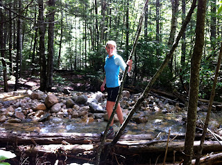
Here we are at the end of the trip. All done!


All in all this was our longest distance and number of days trip. With the added kayaking on the end of it, the trip felt extremely well-rounded. We couldn't have asked for a better trip. So Scenic, but still an adventure.


Sunday, July 8, 2012

White Mountains Trip: The PEMI Loop - July 5-7, 2012

Day 1 - BondCliff to Guyot Campsite

Our trip actually started the on July 4th at the Franconia Brook tentsite just outside of Lincoln Woods trailhead. The idea was to camp and get an early jump on hiking in the morning.

There were 24 tentsites, so finding one was not a problem. There is a forest ranger that checks in with you in the evening, but it is just to say hi and make sure all is well. There was no cost to stay here. He even ofter to filter our water for us should we have needed that. We ended up grabbing site #2 which was pretty close to the river and had a decent number of trees to hang a tarp. (Most of the sites have many trees over there.) It is certainly possible that there are better tentsites than the one that we picked, but we had to decide on our quickly due to the on coming rain just minutes away.

Here's our new tarptent all zipped up from the rain...We didn't have fireworks for the 4th of July, but we certainly had a show of thunder and lightening that night!


The backside of our Franconia Brook tentsite; just on the other side lies the East Branch of the Pemigewasset River


We used the little blue tarp to cook our dinner that night while protected from the rain. Good thing that we decided to bring this tarp at the last minute. We had one of my favorites: Mac & cheese with tuna and Mrs. Renfro's hot salsa. We had hoped to build a fire that night (since once you get above treeline, fires are prohibited), but even though the rain had stopped there was nothing but little kindling sticks that had dry enough to burn.

Compared to the last trip (to the Manistee River), we had significantly reduced the base weights of our packs. The target was that the lower weight would be enough to keep us moving on our feet and able to cover more miles (especially) considering much of the trip is vertical too! We are be no means UL, but have made some serious strides to removing unnecessary luxuries that aren't multi-purpose. I can thank Mike to pushing me to do this :)
In order to get on the trail we planning to first to head up, we had to cross the branch Pemigewasset River. This was my first water crossing. Although the river didn't get that deep (just under my waist), I was still glad to have trekking poles. This made the feat easy - except for being alittle cold. Here's a picture of Mike after he crossed over the Pemigewasset River. You can't see them, but he's waving his neon yellow trekking poles.

Detour: Starting the PEMI loop counterclockwise

Originally, we were planning to start the PEMI loop on Osseo Trail, which links up from Lincoln Woods Trail. Unfortunately, after the water crossing, we ended up on Lincoln Brook Trail (note the close name.) While it would have been nice to see 13 Falls (that is where Lincoln Brook Trail was eventually head), we wanted to get out to the ridgeline. We had to retrace our steps, but were now actually much closer to Bondcliff trail, than Osseo Trail. We made the executive decision to hike the PEMI loop CCW instead of CW. We were now headed up to the alpine zone in the Bondcliff.

Bondcliff trail starts out flat and is actually an old logging railroad. You can see the all old the railroad ties and this trail is exceptionally straight. Now that this region is designated wilderness, nature has taken back over, but the trail still gets to take advantage of the line already created from those logging days - kinda neat!

Bondcliff Trail is flat for a while, but then starts heading up the side of the bonds quickly...if you are looking for many switch-backs, don't bother, this trail is mostly hiking straight up the small rocks and mini-boulders. This does help you get to your destination faster. The other nice thing about this trail is the frequent water sources, one spot was where we stopped to eat a quick snack/lunch. This made getting water for our later climb very convenient.

Bondcliff

We had it to Bondcliff just after lunch time, and had a little snack at the top. It felt good to just sit and relax for a bit. Bondcliff is a vast open spot; there is a great sense of having the summit to yourself (even if you really don't.) We took some pictures of Franconia Ridge from Bondcliff - that's where we would be headed on the 3rd day of our trip. We also took our pictures on the popular Bondcliff ledge. That's Mike in yellow and me in the red.

Mount Bond

The Bondcliff Trail continues up to Mount Bond. The clouds were in really low here so we don't have great pictures, but we did run into a group of dayhikers that gladly snapped a photo for us. This was the last summit before Guyot campsite. There is a 0.5 mile off shoot from the Bondcliff trail where you can go to West Bond for the sunset. During our time there, I am not sure how well things cleared up for a good view that night. (We didn't summit West Bond.) On a clear night, I hear that this is a very nice view though.

Night 2: Guyot Campsite

Guyot campsite was our second night destination. The topo map made it look like this campsite was going to be up higher than it was. At the end of this 1st day, it just seemed we headed down and down to get to the campsite. The campsite is run by the AMC, so for 2 people it was $16. All the small platforms were taken, so we had to use a group one. We ended up sharing with a girl and guy who had been at the greenleaf hut last night - stuck in the storm. The were also doing the PEMI loop, but this was the last night of their hike. They were heading just down Bondcliff tomorrow.

It took alittle extra time to set up the Tarptent on the platform since it is not a free standing tent. However, with the tiedowns provided (hooks on the side of the platform) and the rocks to hold down the other lies, the tent stood just as it normally would. It was impressed by the versatility of this tent, since stability had been my hesitation upon getting it. Random comment: It is probably not likely that these "large group" platforms could easily hold more than 2 tents...so I am not sure why they just don't call them double platforms instead of "group" ones.

Guyot campsite had a designated cooking/cleaning area and nice spring to get water. The people there were all friendly and several chatted about where they had hiked for the day. It was really cool to realize how many different trails and options there really are out here. Everyone was just doing their own thing.
Mike after setting up the tent at Guyot Campsite

Day 2 - Twinway to Garfield Trail

The second day  began with hiking to the top of Mount Guyot (very close to the campsite.) Then came an easy traverse for a bit before heading up to South Twin. Coming down South Twin was probably one of the most technical parts of the trip, and where I had to learn to use my trekking poles better. Part of the decent from South Twin brings you near the Galehead Hut. This is where we stopped for a short break along with several other hikers. This AMC hut was so much nicer than I had expected!! (built in the last few years) They were serving some blueberry coffee cake and some other homemade bars. Mike tried the coffee cake and said it was very tasty.

From Galehead hut, we continued down South Twin until the trail finally starts heading up again on Mount Garfield. Between the down and up here, there was significant vertical put in this 2nd day. We had heard that the climb up Garfield was very difficult, but we didn't find it to be much worse than some of the other short stretches of bouldering we had to do earlier. Halfway up Mount Garfield is the entrance to the campsite. There is a little spring-brook right at the trail, which was the water source for the campsite. This is alittle hike down from the actual platforms once you get up there. Fortunately, one of the other hikers from Galehad had mentioned to fill up water here before heading to the campsite - unless you don't mind coming back down the steep path for water again.
Top of Mount Guyot.
This was taken by a group of 4 guys all we packs that looked to be packed with a ton of stuff - just for 3 days


Views from the Top of South Twin
View of parts of the Presidental Range from South Twin


I love this picture. It captures the essence of all the different types of hikers out at Galehead Hut.


Here's an example of the trail on the South Twin decent.

Night 3 - Garfield Campsite

We spent our last night at Garfield Campsite. Again we had platform camping because there aren't really any flat spots on the side of the mountain. This time we had our own platform, but were right next to a couple doing all 48 summits in the White Mountains (not all at once), and a AT through Hiker. The through hiker was pretty chatty and it was interesting to hear about what the experience is really like. For example, I didn't know that most of those people take "zero" days where the just catch up on rest and other things in town; therefore, there are some days these guys don't coverage any mileage. He was explaining how its really easy to do 15-20 miles per day on certain parts of the AT.
Tarptent on the platform again.
We had a great pitch for the second night on the platform.
Good thing...it was really windy up on Mount Garfield that night.


Day 3 - Garfield to Lincoln Woods

The 3rd day of the trip was by far and away our most difficult day...mainly because of the mileage and vertical we had to cover to reach back to Lincoln Woods. Our third day trip was Mount Garfield > Mount Lafayette > Little Haystack > Mount Lincoln > Mount  Liberty > Mount Flume > Osseo Train > Lincoln woods. Most of these summits were along the Franconia Ridge, but it still didn't take away the vertical up and down between summit to summit. We ended up leaving camp at 6:30 am to be sure to allow ourselves plenty of time to get back to the car before dark. This first picture is the trail to Mount Lafayette. Look closely, you can see some hikers near the top! (That would be us soon...)
Trailhead at the top of Mount Lafayette. We had great views here.


Franconia Ridge offers some of the best views...but it also gives an intimidating look at what is yet to come. The best feeling came at the end when Mike reminded to reflect back to seeing Mount Liberty, Mount Flume, and the decent of Osseo trail far, far off in the distance and how I thought we had so far to go. Sure enough, (even with out feet hurting some) we descended down the 4.4 miles of Osseo train much faster than I thought...and definitely in time for a hearty dinner!

At the top of Mount Liberty...only Mount Flume remained yet to summit
Mmmm...our dinner after the loop
Click here for Full picture album.